One of the toughest roads in Japan | Walking through the dark mountain pass in Higashiosaka

``Kuragaritouge'' is a steep slope that is said to be the ``worst road'' in Kansai. Hiraoka Station and Nukata Station are approximately 30 minutes from Osaka city by Kintetsu train. The ancient road that stretches between them, the Kuragarigoe Nara Kaido, is one of the steepest in Japan, and is famous not only in Kansai but also in Japan, and is visited by many hikers. Walk along the ancient road that was once the shortest route between Osaka and Nara prefectures. We will also introduce you to ...
What is Kuragaritoge?
The Ankoshi Nara Kaido was once one of the shortest routes connecting Osaka and Nara, and was used for the transportation of people and goods. Ikomayama is located on the prefectural border between Osaka and Nara, and seems to have been used as a road to cross the mountain. In the Edo period, pilgrimages to Ise became popular, and there were many travelers, making the area bustling with inns and teahouses.
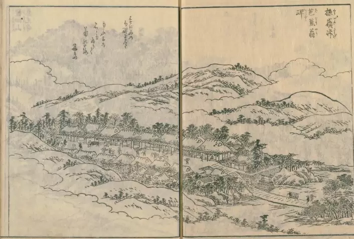
A 120-year-old tourist guidebook of Kawachi famous places, Volume 6, Dark Pass (from the National Diet Library)
By the way, it is said that the name "Antoge" came from the fact that it was dark even during the day due to the thick trees, and also because it was a slope so steep that it could overturn a horse's saddle.
Although the number of people using this road has decreased in modern times when transportation such as trains has developed, the road back then is still used as National Route 308. The steep path that was once climbed by foot remains the same as it was back then, and the steep slopes that remain have been featured on TV programs as difficult places for vehicles to pass. Recently, it has become a popular spot on YouTube with a total of 7.5 million views in the top 10 views alone. (There are many videos of people traveling by car, but this is not recommended.)
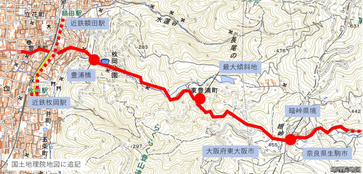
This is the route I will introduce this time.
Starting to climb
3 minutes walk along the railroad tracks from Hiraoka Station or Nukata Station on the Kintetsu Nara Line. National Route 308. This is the road called ``Kuragari Goe'' that stretches from the center of Osaka towards Nara. From here, it takes about 80 minutes to walk for about 2.5 km to the prefectural border, the dark pass, with a difference in elevation of 400 meters.
The road surface is concrete instead of asphalt and I have a feeling it will be a rough road. The slope is not suitable for asphalt construction, so it is paved with concrete. Please note that there are no vending machines at this time.
(If you are driving, please follow the local signs and take the detour from the north [left side of the photo])
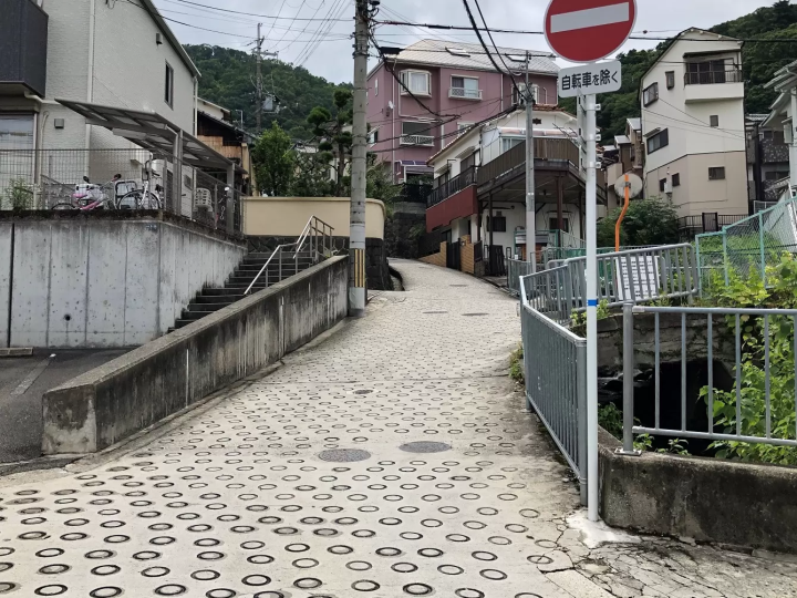
There is a ring groove in the concrete on a steep slope.
I'm exhausted just here...
If you walk for a few minutes from the railway side, you will reach Hiraoka Park, one of the Osaka Prefectural Parks. One of the spots is Toyoura Bridge. The red bridge is impressive against the blue autumn leaves. It is a famous autumn foliage spot in Higashiosaka where the autumn leaves are beautiful. You can do this by crossing the bridge and taking the promenade down to the river.
Just getting from the starting point to this point is quite an incline, and I'm wondering what to do next. (Will I be able to climb the mountain safely?) If you are not confident in your legs, you should turn back at this point as you have experienced the ``Antoge Nara Kaido''.
As a side note, Hiraoka Park is popular as a park where you can enjoy the nature of Mt. Ikoma. You can enjoy the feeling of hiking just by walking along the walking paths in the park. The Hiraokayama Observation Deck in the park is my recommended spot.
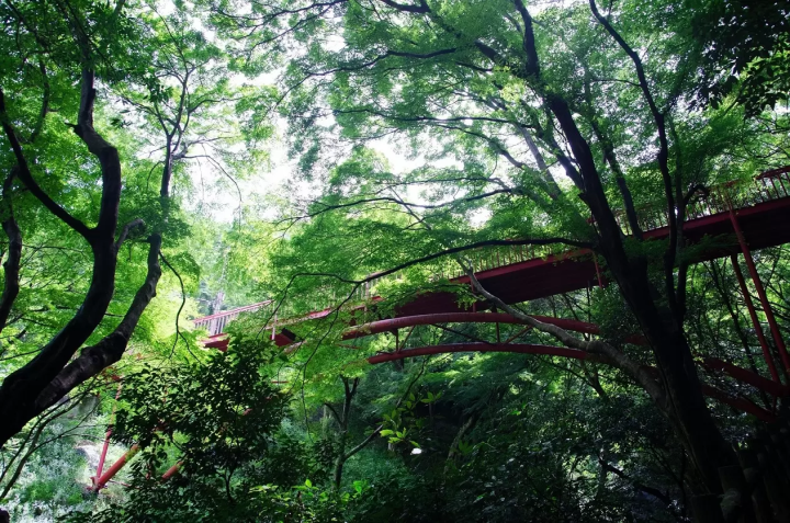
Toyoura Bridge where red stands out against fresh greenery
What does it feel like to walk?
This road is sloped all the way and continues to climb towards the dark pass. The road is narrow, so be careful of passing cars, motorcycles, and cyclists. Along the way, you'll see a temple called Kannon-ji, stone signposts, and groups of stone Buddhas in places, making it reminiscent of ancient roads. What was the scene like when it was frequently used? If you imagine that there was no concrete paving at that time, it must have been quite difficult... Walk forward while listening to the sound of the river flowing from the mountain. There is an electronic bulletin board along this road that tells you the current temperature. It can be very dangerous during heavy rain or when roads are frozen in winter. Although the interview was conducted in June, it had rained in the morning, so the road was wet and one had to be careful of slipping underfoot. (There are drainage grooves on the concrete road surface, so please be careful when riding motorcycles or bicycles.)
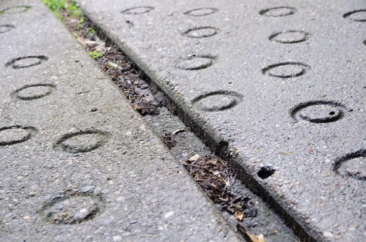
Dark pass maximum slope
It takes about 40 minutes to start climbing from the railroad tracks. This is the spot that became the reason why it is known as the "Akudo" all over the country. This sharp curve was made to cross the stream twice, and the inclination angle was (I think) calculated to the limit in order to somehow manage to climb this height difference by car. Its maximum slope is said to be about 40%.
This curve may have been created in order to somehow pass the road through a difficult point on the ancient road, Ankoshi Nara Kaido (this is just my imagination).
After looking at this place for a while, I noticed numbers from other prefectures as well. The white smoke and smell of burnt tires left behind by cars climbing the mountain. It is impressive to see a car descending leaving behind the smell of the metal brakes rubbing. People driving should also be nervous. I now understand what it means to be called a cruel road.
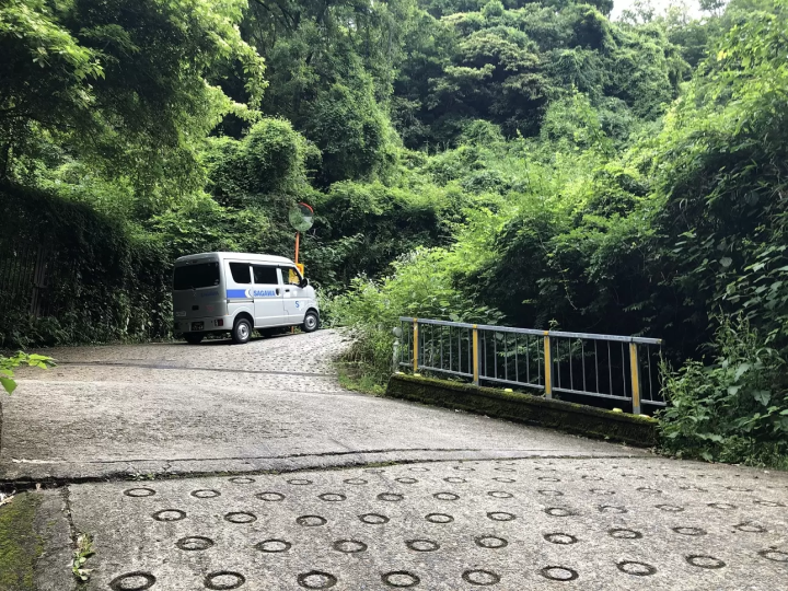
Local cars and delivery vehicles are in line as expected. It runs smoothly without any white smoke.
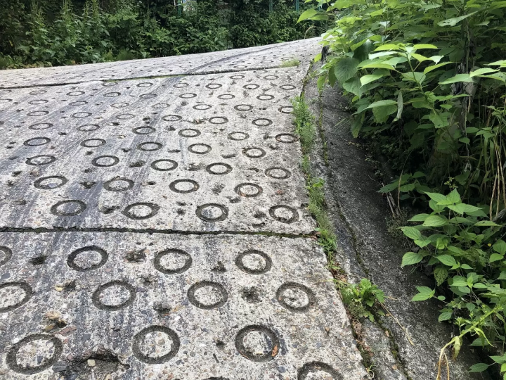
The burnt and sticky tire marks testify to the ruggedness of this trail.
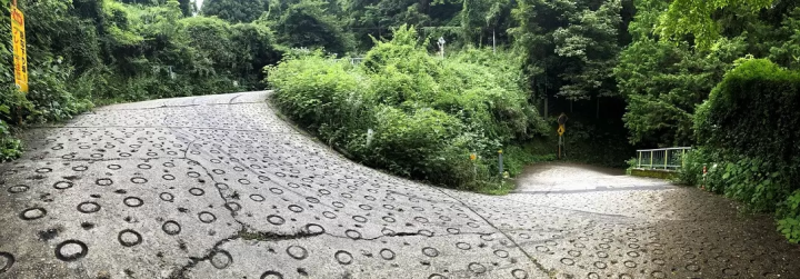
The combination of steep slopes and curves resembles a Möbius strip that appeared in Higashi-Osaka. (Panorama photo)
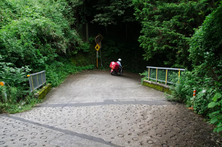
I have a lot of respect for the delivery staff who walk up this steep hill every day.
The scenery of Satoyama beyond that
Once you exceed the maximum slope point, you will continue to climb toward your destination, the dark pass. Along the way, there is a place on your right that has spring water called ``Kobo no Mizu''. There is a stone monument called Kasatoba, which is a cultural property of the city, and was apparently built in 1284 during the middle of the Kamakura period! It has been gushing out for over 700 years, and may have served as a resting place to water the mouths of travelers. (Currently, this water is not drinkable.) As you continue towards the prefectural border, you will see a rural landscape of Satoyama.
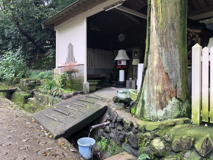
It has probably been popular for hundreds of years.
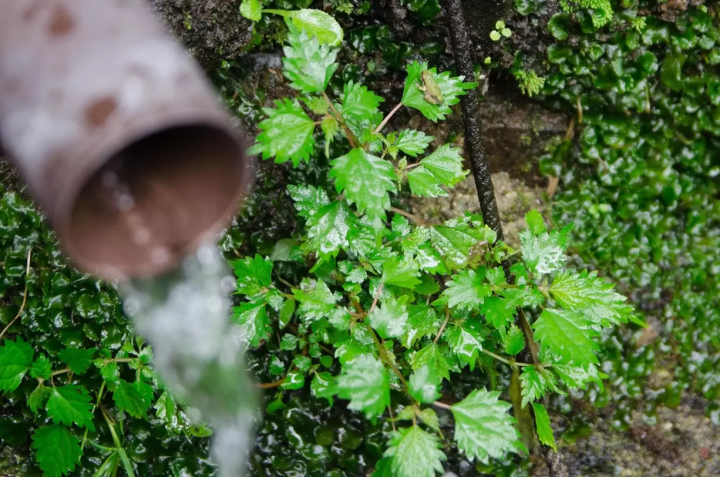
The springing water of Kobo. The frog on the leaf is soothing.
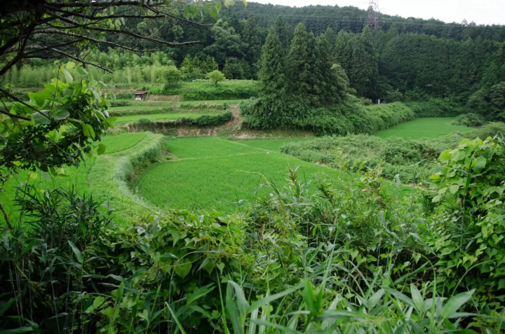
The rice terrace scenery is nice, isn't it?
The stone pavement is a remnant of those days.
As you approach the prefectural border, your feet will turn to cobblestones. In the past, the path was muddy underfoot, so stone pavement was laid in the Edo period to make it easier to walk on during the sankin kotai shift. This road was often used for pilgrimages to Ise. Is it the same stone pavement from back then? If you think that this stone is a cobblestone that people walked on hundreds of years ago, it feels romantic. (It may have been re-laid)
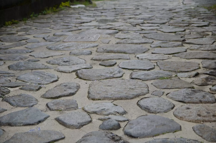
Are the cobblestones the same as they were back then? I would like to compare it with old photos.
There is a stone monument that marks the border between Osaka and Nara prefectures. This is a photo spot. I would like to take a photo to remember my visit to the dark pass.
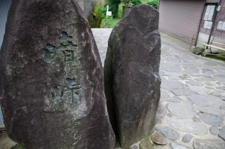
Click here for popular photos of #Antouge
After arriving at the dark pass, either return to Kintetsu Hiraoka Station or Nukata Station on the Osaka Prefecture side, or head to Kintetsu Minami-Ikoma Station or Ikoma Station on the Nara Prefecture side.
Ikoma gourmet spot from Dark Pass
In Antoge, there are spots reminiscent of teahouses of the time, such as `` Touge Chaya Suehiro, '' and in Ikoma City, Nara Prefecture, Ikomasan gourmet food such as `` Lucky Garden '' and `` Tomo Yuyu '' are very popular.
Check out the gourmet information around Antoge on Google Maps
Another recommended point of this area is that there are many restaurants with great views that take advantage of the nature of Mt. Ikoma. The atmosphere of the renovated old folk house is quite otherworldly. There you can enjoy international cuisine including ethnic cuisine. You can enjoy colorful dishes on the plate and a luxurious time that can only be experienced at Mt. Ikoma.
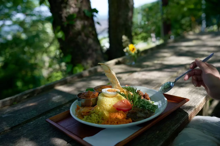
Lucky Garden is a popular gourmet restaurant that represents Mt. Ikoma.
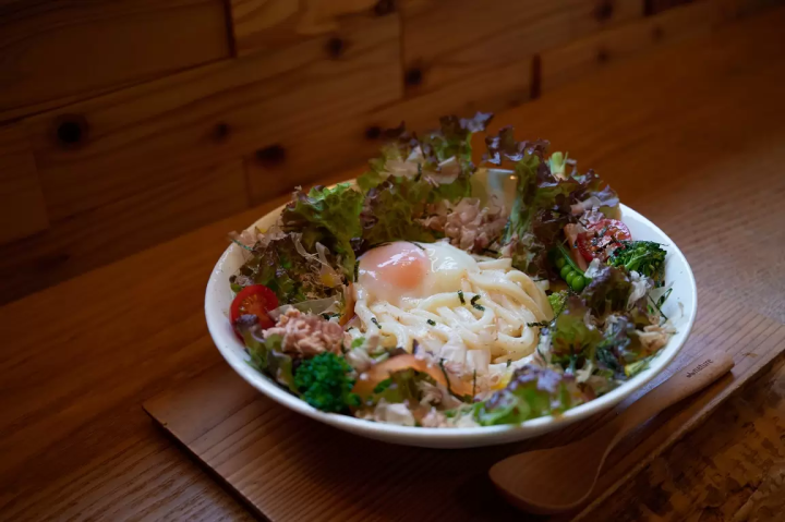
Tomoyyu is a spot where you can enjoy lunch or a cafe while looking out at the rural scenery of Ikoma.
summary
The Dark Pass of Nara Kaido is said to be one of the most ``toughest roads'' in Japan. The slope attracts attention, but there are also traces of the area being once a popular destination for Ise pilgrims, which shows the depth of its history. If you like popular spots and ancient roads, why not visit it once?
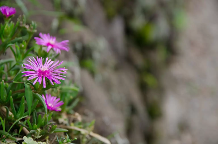
Cute flowers blooming on the roadside. It goes well with the landscape of Satoyama.
please note
・Please be careful as the road surface is very slippery during and after rain.・Please be careful not to obstruct vehicle traffic.・There are no places to buy drinks after Hiraoka Station or Nukata Station, so be sure to buy them in front of the station.・Please walk quietly as you may pass by private houses.
access
Approximately 40 minutes walk from Hiraoka Station on the Kintetsu Nara Line to the highest slope spot. From there, it is about a 40 minute walk to the Antouge prefectural border.
■Experience-based tourism that takes advantage of the manufacturing town ■“Rugby (sport)” tourism that takes advantage of the rugby town ■“Culture/downtown” tourism that takes advantage of cultural resources, shopping streets, etc.
The contents on this page may partially contain automatic translation.







![[Kanazawa] Enjoy the world of gold leaf to the fullest in the city with the highest production volume in Japan](https://resources.matcha-jp.com/resize/720x2000/2025/11/12-249564.webp)
![[2026] Family Winter Trip to Suzuka Circuit! – For Both Day trips and Overnight Stays!](https://resources.matcha-jp.com/resize/720x2000/2025/12/26-254097.webp)
![[Northern Okinawa] 4 Recommended Cosmos Fields in Okinawa | Sunflowers and Cherry Blossoms in the Same Season!](https://resources.matcha-jp.com/resize/720x2000/2024/08/12-192028.webp)
