Hike Beginner-Friendly Nature Trails with Panoramic Views in Matsusaka
This time, we will introduce three mountains in Matsusaka City, Mie Prefecture that are easy even for beginners to climb and offer special seasonal scenery and magnificent views.

Written by
Matsusaka City, Mie Prefecture is located almost in the center of Japan, where you can enjoy world-class gourmet Matsusaka beef, rich history and culture, and beautiful nature. During the Edo period, Matsusaka was the final post town for pilgrimages to Ise-mairi (a pilgrimage to Japan's highest-ranking shrine). These merchants succeeded in trading Matsusaka cotton in Edo and brought prosperity to Matsusaka.
This service includes sponsored advertisements.
-
Table of Contents
- Whenis Hiking Season in Matsusaka?
- Mt.Takami
- Mt.Hossaka
- TheNational Historic Site, Hakumaijo
- summary
Whenis Hiking Season in Matsusaka?
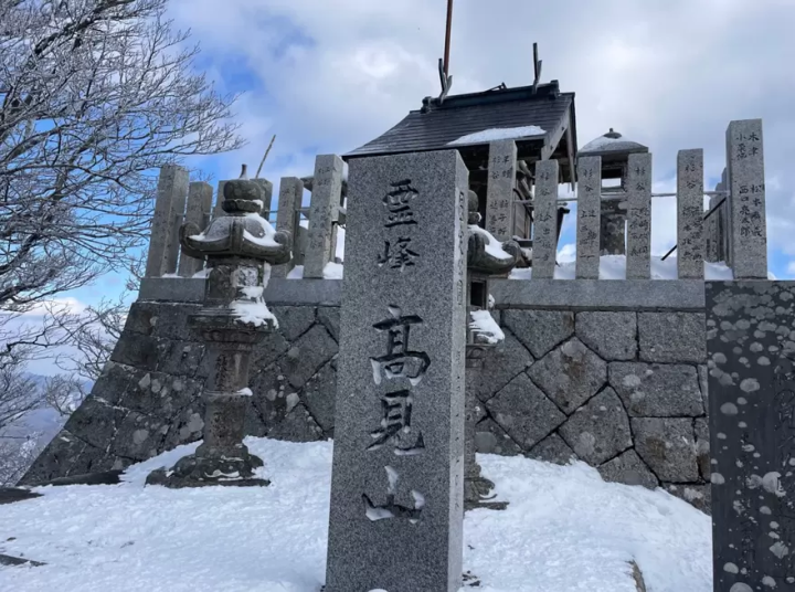
Mt.Takami
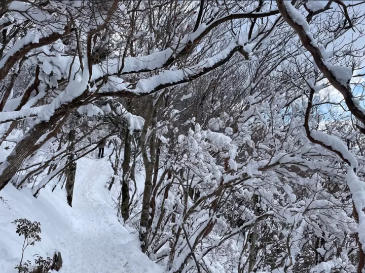
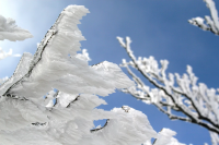
Listedas one of the Kansai region’s 100 famous mountains and nicknamed the Matterhornof Kansai for its shape, Mt. Takami stands at 1248.4 meters tall on the borderbetween Mie and Nara Prefectures. While Mt. Takami is popular all throughouthiking season, winter is a special time particularly for the chance to see rimeice on the trees around December to February.
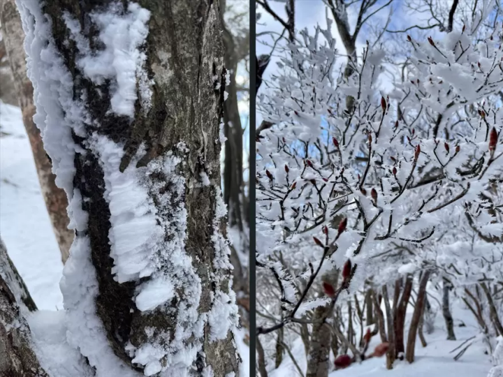
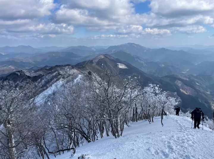
Whilehiking towards the top, winter hikers may be surprised with an opportunity towalk under arches of tree branches covered in fluffy snow..
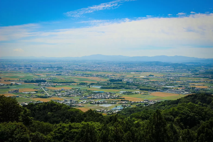
A sweeping view of surrounding mountains and villages of both Mie and Nara Prefectures awaits hikers at the top where a viewing deck and a rest area provide shelter and a fantastic lunch spot.
Mount Takami
[Altitude] 1248.4m
【access】
- Take the bus bound for Kamiki-Kaji from JR or Kintetsu Matsusaka Station for 110 minutes and get off at the last stop
- 90 minutes from Matsusaka IC on the Ise Expressway via National Route 166
Best time to see frost: December to February
Mt.Hossaka
Mt.Hossaka stands at 757 meters tall as one of the Ise Three, a collection ofthree mountains that has served as navigation landmarks for fisherman in theIse Bay since olden times.
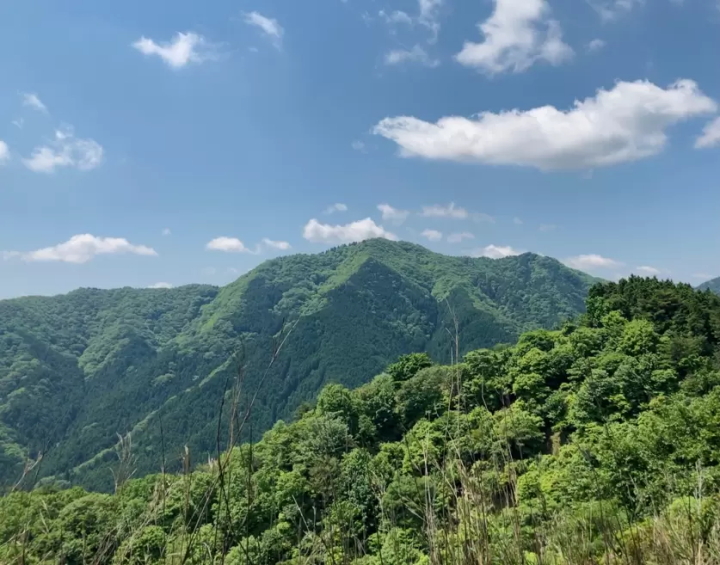
▲Mount Horisaka in late spring

▲Viewingplatform at Mt. Hossaka’s peak.
After anestimated 50 minutes for the ascent, hikers can step onto the viewing platformand see the Ise Bay stretching before them into the distance. On early autumnmornings, a sea of clouds may cover the valley in a splendid sunrise view.
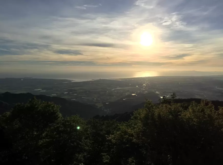
▲ Sunriseover the Ise Bay from Mt. Hossaka.
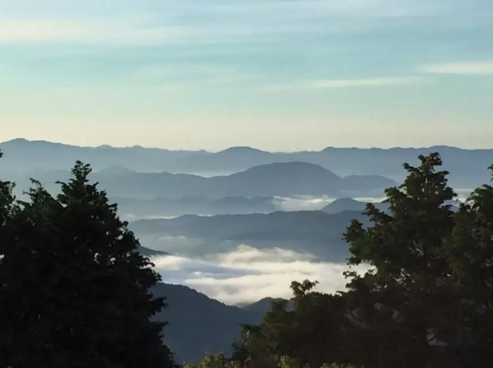
▲Thesea of clouds, or unkai, from Mt. Hossaka in the early morning.
Statuesof bodhisattvas watch over travelers on their way, surrounded by offerings. Onestatue sits on Mt. Hossaka’s secondary peak just a short walk from the viewingplatform.
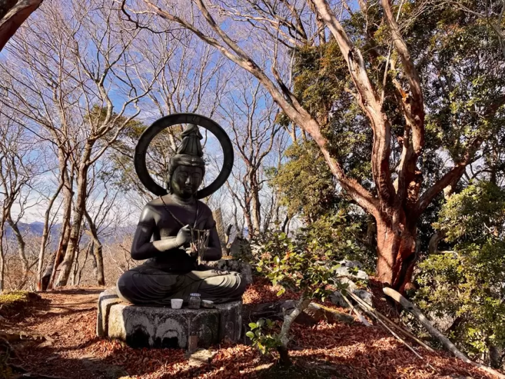
▲Buddhastatue established on Mt. Hossaka in the late 1680s.
Hikers looking for a longer journey can continue from Mt. Hossaka on to Mt. Kannondake for another viewpoint, and the historic castle site Hakumaijo.
Mount Horisaka
[Elevation] 757m
【access】
- 25 minutes by bus from Matsusaka Station to Ono, get off at Yokotakiguchi and walk 90 minutes
-Approximately 10 minutes from Matsusaka IC on the Ise Expressway
TheNational Historic Site, Hakumaijo
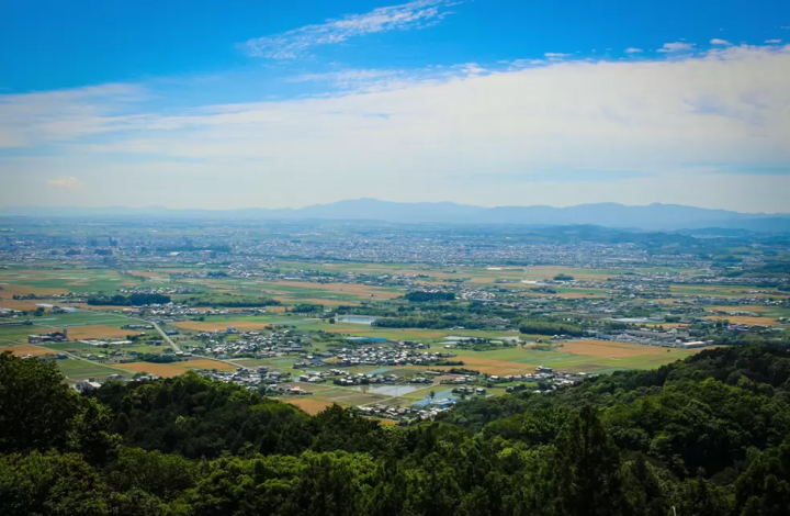
Hajumaijois part of the site of Azaka Castle, which was built in 1335 and eventuallydemolished in 1567. This castle site, now a national historic site, stands ataround 300 meters overlooking the Ise Bay and the city of Matsusaka.
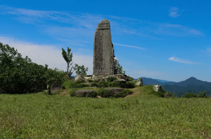
▲Monumenton Hakumaijo in summer.
The nickname Hakumaijo, meaning “white rice castle,” comes from a legend of a siege of Azaka Castle in 1415 when, after the water supply was cut off, the beseiged general tricked his opponent into believing the castle still had access to water by pouring white rice over his horses and pretending to wash them. This led to the opposing army’s retreat and ended the siege.
Thissite is a mild hike at an average of around 40 minutes for the ascent. Hikersare encouraged to relax and enjoy the view from the top over a snack and a warmdrink!
Shirayone Castle (Asa Castle ruins)
[Elevation] 300m
【access】
-Approximately 32 minutes from Matsusaka Station to the Mie bus stop by Iwakura Kotsu bus
-Approximately 10 minutes by car from Matsusaka Interchange
summary
Matsusaka’smountains offer stellar views for hikers of all levels to enjoy in a variety ofseasons. Save this article as reference for a quiet place to spend time innature on your next trip to Japan!
[Click here for detailed tourist information on Matsusaka City, Mie Prefecture ]
Matsusaka City, Mie Prefecture is located almost in the center of Japan, where you can enjoy world-class gourmet Matsusaka beef, rich history and culture, and beautiful nature. During the Edo period, Matsusaka was the final post town for pilgrimages to Ise-mairi (a pilgrimage to Japan's highest-ranking shrine). These merchants succeeded in trading Matsusaka cotton in Edo and brought prosperity to Matsusaka.
The contents on this page may partially contain automatic translation.
Top Articles


![[SHIMAKAZE: A Train You Should Ride at Least Once] The Most Comfortable Direct Ride to Ise-Shima from Nagoya, Osaka, and Kyoto](https://resources.matcha-jp.com/resize/720x2000/2025/06/09-235798.webp)


Special Features
More


![[Latest] Complete Guide to atmos Exclusive Sneakers & Special Edition Models | Apparel and Upcoming Release Information](https://resources.matcha-jp.com/resize/720x2000/2026/05/28-264818.webp)