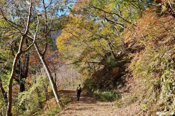
5 Intermediate Hikes Near Tokyo - Amazing Scenic Trails!

Tokyo is surrounded by countless hiking trails with varying difficulty. Take in nature and reenergize with these five fantastic hikes in Kanagawa, Yamanashi, Chiba, and Saitama, that are easily accessible from the city.

Written by
This is the official account of MATCHA's editorial department. Our articles feature useful travel information for visitors to Japan, from how-to guides to recommended places to visit.
This service includes sponsored advertisements.
Explore the Great Outdoors with Hiking Close to Tokyo
Beyond the city lights of Tokyo is an abundance of hiking routes that range from easy to expert. However, with so many to choose from, it can be challenging to know which one to take on.
Luckily, hiking in Japan is rewarding, no matter which trail you are on or which mountain you decide to climb. With clearly marked paths, friendly fellow hikers, and provisions provided along the way, you will never have a bad experience on any of the peaks.
Read on for a few of the best hikes in Tokyo’s surrounding areas ideal for those seeking intermediate trails that provide a slight challenge.
For those active in Japan, you can shop for hiking, mountain climbing gear, and outdoor goods online at Kojitsu Sanso (Japanese) and find hiking and mountain climbing gear for rent via Yamarent.com.
1. Mt. Nabewari in Kanagawa
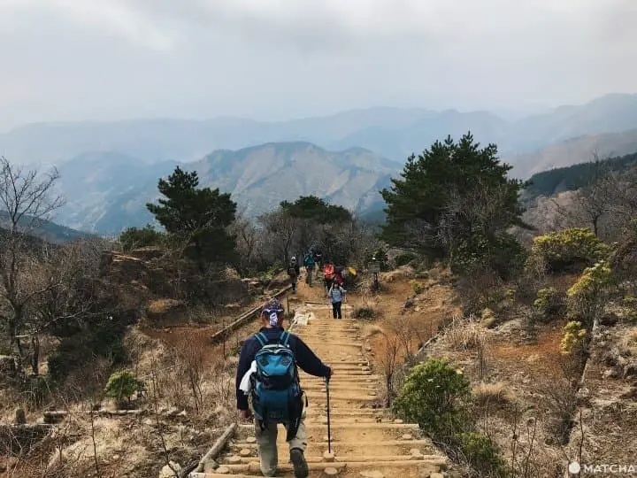
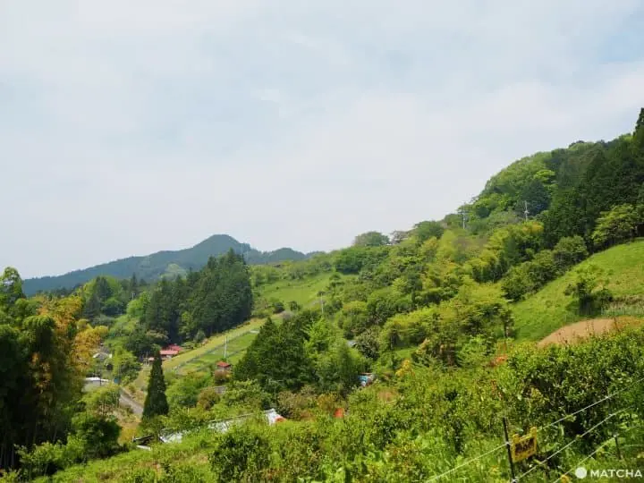
Mt. Nabewari, (Nabewariyama) is part of the Tanzawa mountain range in Kanagawa Prefecture, close to Mt Fuji. It is a relatively challenging mountain hike, with an altitude of 1,273 meters (around 4,177 feet) and takes about six-seven hours to complete.
The first couple hours of the hike are quite relaxing, with only mild elevation inclines. The last hour or so gets more intense as you climb staircase after staircase until you reach the top.

The highlight of the hike is the nabeyaki udon noodles that are sold from a small hut at the summit. For 1,000 yen, you can get slurp up a comforting bowl of noodles while gazing at the stunning view of Mt Fuji. The restaurant, Nabewari Sanso, tends to run out of the noodles quite fast, so it’s recommended to get there before noon to ensure yourself a bowl.

The view of Mt. Fuji from Mt. Nabewari
Nabewari Sanso also provides lodging, so you can choose to stay there overnight to watch the sunrise or sunset.
Difficulty: 3/5
Getting to Mt. Nabewari
From Shinjuku Station, take the Odakyu Line to Shibusawa Station. Then, get on a Kanagawa Chuo Kotsu Bus bound for Okura. From there, follow the trail for Nabewariyama.
2. Mt. Tonodake in Kanagawa
Mt. Tonodake, like Mt. Nabewari, is part of the Tanzawa mountain range. However, it stands slightly higher at 1,491 meters (4,892 feet), making it a little more challenging.
You can actually get there from the summit of Nabewariyama, which will add about an hour and a half to your hiking time if you choose to do so.
If doing Tonodake only, the recommended route is to start from Yabitsu-toge bus station, and then to descend toward Okura bus station.
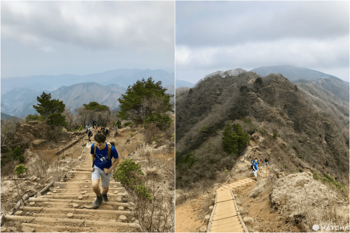
The climb is quite steep throughout, with many stairs and boardwalks. At the summit is a shop with some food and drinks, as well as a bathroom.
You can also see Mt. Fuji on a clear day.
Follow the signs to Okura (大倉) and make your way back down the mountain.
Both Tonodake and Nabewariyama offer tremendous views, beautiful flora, and varying landscapes along the way.
Expect the hike to take around six hours total.
Difficulty: 4/5
Getting to Tonodake
From Shinjuku Station, take the Odakyu Line to Shibusawa Station. Then, get on a Kanagawa Chuo Kotsu Bus to Yabitsutoge. From there, follow the trail for Tonodake.
3. Mt. Mitsutoge in Yamanashi
If you want the best view of Mt. Fuji, Mt. Mitsutoge is the mountain for you. With an elevation gain of about 1,200 meters (3,937 feet), the climb is not too challenging and offers memorable trails and spectacular views.
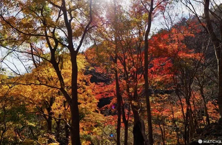
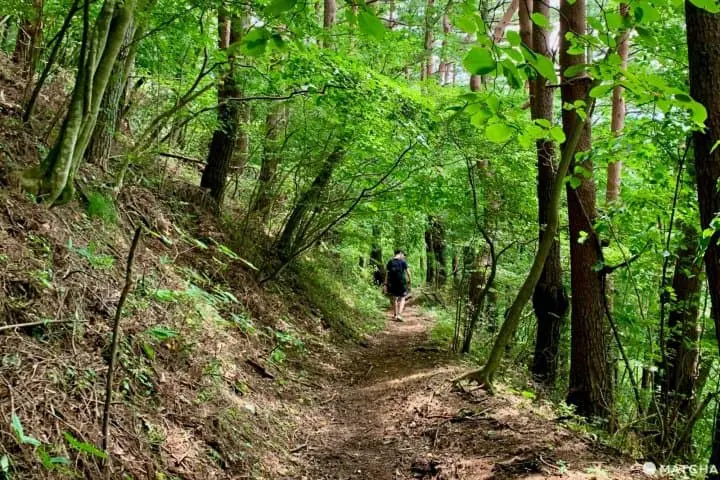
The hike starts on a concrete road, and after about 30 minutes of walking uphill, you will reach the trailhead. Be cautious, as the trail is quite rocky and steep for the 90 minutes or so it takes to get to the top. It also tends to get a bit muddy due to the many water sources around.
Once you pass the 88 Jizo statues, the climb gets quite interesting as you will have to navigate some tricky ridges, old bridges, and some rickety stairs.
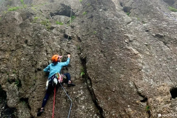
You may also meet some rock climbers during this last bit of the climb, as there is a huge rock wall that reaches to the top of the mountain.
Once you reach the summit, you will be rewarded with a gorgeous view of Mt Fuji
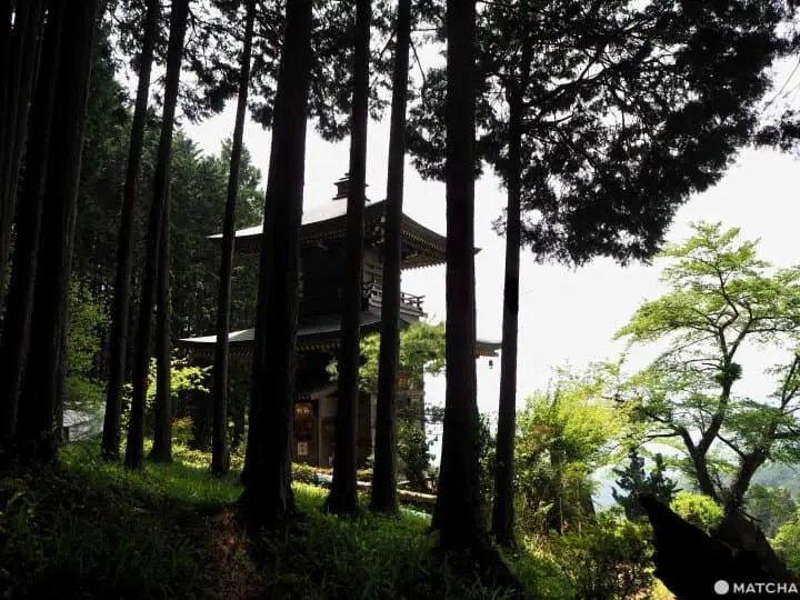
Keep walking a bit further and you will find Mitsutoge Sansou, where you can buy food. You also also eat your own lunch at one of the many benches around, although please be aware that eating at one of Mitsutoge Sansou's benches will cost you 100 yen.
There are several ways to get back down, but the Mt. Tenjo route is quite relaxing and smooth. Some people even trail run up the mountain this way, as the path never gets too steep or rocky.
After a few hours of walking along beautiful ridges and through lush forests, you will arrive near Kawaguchiko Station.
In all, the roundtrip hike should take about six-seven hours to complete.
Difficulty: 3/5
Getting to Mt. Mitsutoge
By bus: From Shinjuku Station, catch a Keio Highway Bus bound for Kawaguchiko. Get off at Nishi Katsura, walk toward Mitsutoge Station, and you will see the signs pointing you toward the trailhead.
By train: Take the JR Chuo Rapid Express bound for Takao, then change to the regular Chuo line at Otsuki. At Otsuki, transfer to the Fujikyuko Line and get off at Mitsutoge Station.
4. Mt. Nokogiri in Chiba
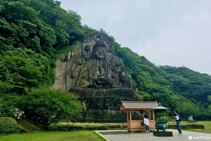
With an elevation of just 330 meters (1,082 feet), Mt. Nokogiri Nokogiriyama is the easiest hike on this list. It is also one of the more engaging hikes, as there are many attractions––two giant Buddhas, many small Jizo statues, over 1,500 arhat statues, temples, and quarries––to keep you busy.

The hike starts in a mystic, ancient-looking forest before reaching the peak, where you will have some great views of the surrounding area.
You can easily spend an hour walking around the summit's entire pathway, which connects all of the different areas and attractions.
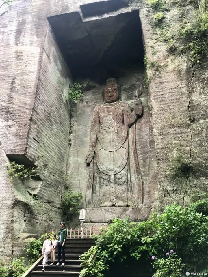
If you are short on time, however, don’t miss the Daibutsu (Great Buddha statue), the hyaku-shaku Kannon, and the 1,500 Arhat statues.
Compared to the other hikes, this one attracts a lot more sightseers and tourists, so beware that it tends to get quite busy on the weekends or on holidays.
Difficulty: 2/5
Getting to Mt. Nokogiri
From Shinagawa Station, take the Keikyu Line to Keikyu Kurihama Station. Then, take a 10-minute bus ride to Kurihama Port. From there, take the ferry to the Boso Peninsula, which leaves once every hour.
Mt. Nokogiri
 Motona, Kyonan-cho, Awa-gun, Chiba 299-1901
5. Koburi Pass in Saitama
Located in Saitama, Koburi Pass is one of the most easily accessible hiking destinations, as it is just 90 minutes from Tokyo.
Suwa Shrina
It is an excellent hike for when you feel like getting out and moving your body in nature without exhausting yourself.
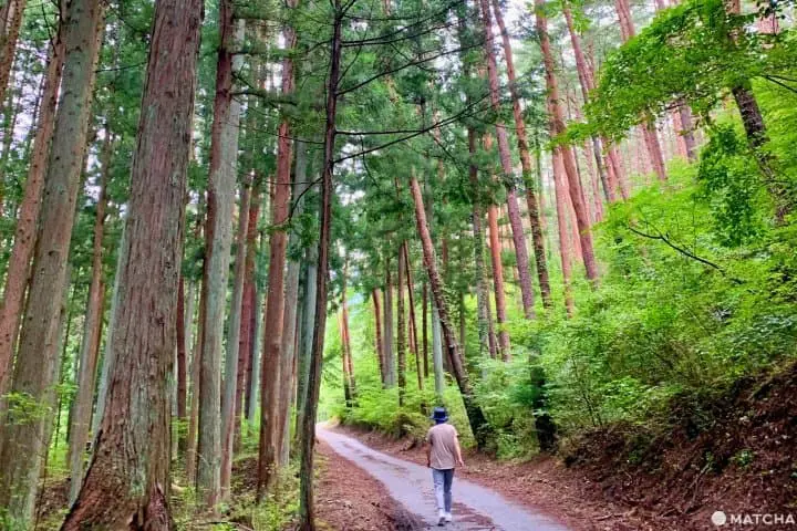
The ascent of 350 meters (1,148 feet) is mostly through a beautiful forest, which takes you to Suwa Shrine just before the peak.
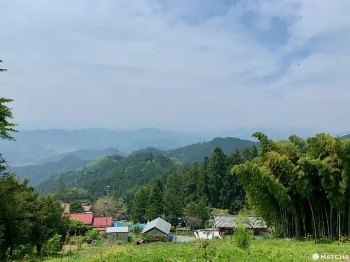
You can also get a nice view of Saitama and even Tokyo Skytree on a clear day.
The whole thing should take just about three hours. You can also extend the hike if you wish, as there are a few connecting trails that will take you farther up the mountain.
Given that it’s slightly off the beaten path, it tends to be more peaceful and isolated than other more popular hikes in the Saitama area.
Difficulty: 2/5
Getting to Koburi Pass
From Ikebukuro Station, take the Seibu Ikebukuro Line to Hanno, then transfer to the Seibu Chichibu Line to Agano.
Get out in Nature and Break a Sweat!
Hiking is a great way to explore Japan and gain a new perspective of all that's around you. Just be sure you come prepared with some layers, lots of water, snacks, and good quality shoes. As mentioned earlier, hiking and outdoor goods in Japan can be found online at Kojitsu Sanso and rented via Yamarent.com (Japanese).
If you're looking for even more hiking routes in the Tokyo area, you can find five more options here.


Main image by Pixta
This is the official account of MATCHA's editorial department. Our articles feature useful travel information for visitors to Japan, from how-to guides to recommended places to visit.


Related Article


Special Features
More